Flight Opportunities Community of Practice
July 6, 2022
JPL’s Venus Aerial Robotic Balloon Prototype Aces Test Flights
October 11, 2022NOAA Completes FVR-55 Operations in Marine Stratocumulus Clouds to Measure Atmospheric Aerosol Properties needed to Improve Climate Model Simulations

ARTICLE AND FIGURES PROVIDED BY: KENNETH VIERRA (SCIENCE TECHNOLOGY CORPORATION/UXS RESEARCH TRANSITION OFFICE) AND PATRICIA QUINN (NOAA/PMEL)
Scattering and absorption of solar radiation by atmospheric aerosol particles affect Earth’s radiation budget, including cooling at the Earth’s surface (Intergovernmental Panel on Climate Change (IPCC) 2014; NOAA Science Council Fact Sheet). Aerosols, Weather and Climate). Cooling can also occur when aerosol particles take up water and form cloud droplets which can increase cloud brightness. The degree to which aerosol direct forcing and interactions between aerosols and clouds are cooling the planet and offsetting warming by greenhouse gasses is highly uncertain. According to the IPCC, climate forcing associated with aerosol-cloud interactions contributes the largest uncertainty to total radiative forcing estimates. Vertical profiles of aerosol and cloud properties are required to improve models and decrease uncertainties, particularly over oceans due to the susceptibility of marine clouds to small changes in aerosol concentrations (Rosenfeld et al., 2019).
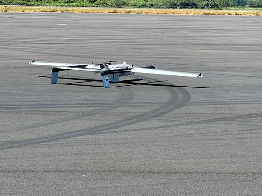
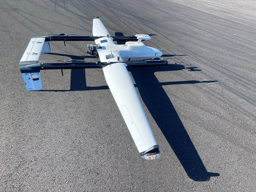
Between August 8th and 18th, 2022, the NOAA Pacific Marine Environmental Laboratory (PMEL) and the University of Washington Cooperative Institute for Climate, Ocean, and Ecosystem Studies (CICOES) used the L3Harris Fixed Wing Vertical Takeoff and Landing Rotator (FVR-55) uncrewed aerial system (UAS) to measure aerosol and cloud vertical profiles with the NOAA Clear Sky and Cloudy Sky scientific payloads (descriptions provided below). The sensors in the payloads measure aerosol properties relevant to aerosol direct radiative forcing and aerosol – cloud interactions. The mission was supported, in part, by NOAA’s Earth Radiation Budget (ERB) program that was initiated to investigate natural and human activities that might alter the reflectivity of marine boundary clouds. The UAS measurements reported here will provide critical information on the processes that lead to the brightening of marine clouds with a potential cooling of the Earth’s surface.
Participants included staff from the NOAA Oceanic and Atmospheric Research (OAR) Pacific Marine Environmental Laboratory (PMEL), the University of Washington Cooperative Institute for Climate, Ocean, and Ecosystem Studies (CICOES), the NOAA Uncrewed Systems Research Transition Office (UxSRTO), Office of Marine and Aviation Operation (OMAO) UxS Operation Center, L3Harris and the Tillamook UAS Test Range operated by Near Space Corporation (NSC) (Figure 1).
The FVR-55 was developed by Latitude Engineering, LLC (later acquired by L3Harris Technologies) through NOAA Phase I and II Small Business Innovation Research (SBIR) awards. Continued development and operations were funded and logistically supported by the OMAO UxS Operations Center (UxSOC) and the OAR Uncrewed Systems Research Transition Office (UxSRTO).
In March of 2022, NOAA and L3Harris conducted successful, fully autonomous shipboard operation of the FVR-55 with Clear Sky and Cloudy Sky payloads onboard. A total of 11 flights and 14.9 hrs of flight time were completed, demonstrating the ability of the UAS to repeatedly land within a small confined space on a moving ship. Operations were conducted under line of sight conditions with an altitude ceiling of 1200 ft due to restrictions under the Certificate of Authorization (COA) in place.
The August 2022 measurements took place at the NSC Tillamook UAS Test Range (TUTR). With the flight plans developed by NOAA and TUTR to meet the test requirements, including use of NSC COA and tracking aircraft, beyond visual line of sight (BVLOS) operations were conducted above the Tillamook Airport and in the offshore Warning Areas more than 12 NM off the Oregon coast. The tracking aircraft escorted the UAS through non-controlled airspace to the Warning Areas and deconflicted with other air traffic. NSC personnel communicated flights to the local FAA ATC (Seattle Center) and managed airspace deconfliction. The UxSOC UAS Division developed the Concept of Operations and acted as Mission Commander during flight operations. Mission Control was based out of the NSC Operations Tower (Figure 2). For line of sight flights above the airport up to as high as 4500 ft, L3Harris and UxSRTO staff functioned as visual observers. The science team directed the Pilot-in-Control (PIC) to change flight tracks based on incoming, real-time data from the payloads.
A total of 14 flights (38.5 hrs) were successfully completed, nine with the Cloudy Sky and five with the Clear Sky payload (Table 1). BVLOS vertical profiles were conducted from the surface up to 10,000 ft on a not-to-interfere basis within Tillamook Class G Airspace or in offshore Warning Areas subsequent to the chase plane escort. Seven flights were conducted above the airport and 7 were conducted in the offshore Warning Areas. During two of the flights, a Pilot-in-Command (PIC) and a Mission Commander were stationed both in the NSC Operations Tower and at a beach location (Netarts Bay or Bayocean beach). The scientific team was located at the beach to direct flight tracks based on incoming payload data (Figure 3). The PIC was transferred from the NSC Operations Tower to the beach location once the beach PIC detected the plane. All flights were continuously monitored and ultimately controlled by Mission Control based out of the NSC Operations Tower. The PIC at the beach ensured optimal line of sight to the test area and allowed the plane to descend to as low as 400 ft to make below cloud measurements. Flight times ranged from 2 to 4.5 hours. Details about the flights are listed in Table 1.
About the Payloads
NOAA PMEL has developed two payloads to measure the aerosol and cloud properties required for the observation of aerosol direct radiative effects (Clear Sky payload) and impacts of aerosols on clouds (Cloudy Sky Payload) (Figure 4).
PMEL Clear Sky Payload
The Clear Sky Payload (Figure 5) is made up of four instruments: a Mixing Condensation Nucleus Counter (MCPC) to measure total particle number concentration, a 3 wavelength Particle Soot Absorption Photometer (PSAP) to measure absorption, which is a proxy for soot; a Portable Optical Particle Spectrometer (POPS) to measure particle number as a function of size; and a miniature Scanning Aerosol Sun Photometer (mSASP) for the measurement of aerosol optical depth. There is also a temperature and relative humidity probe that extends into the air stream and a filter carousel for collecting samples for post-flight chemical analysis. The weight of the payload is 5.45 kg (12 lbs).
PMEL Cloudy Sky Payload The Cloudy Sky Payload (Figure 6) contains a miniature Scanning Electrical Mobility Spectrometer (mSEMS) to measure the particle number size distribution and a cloud droplet probe (CDP) to measure cloud droplet number concentration and size. Additionally, there are ambient temperature and relative humidity sensors. The payload weighs 5.9 kg (13 lbs).
Depending upon assets and funding, PMEL is looking at using their Clear Sky and Cloudy Sky payloads on L3Harris UAS to participate in the Atmospheric Emissions and Reactions Observed from Megacities to Marine Areas (AEROMMA) experiment in 2023. AEROMMA is a comprehensive study led by NOAA’s Chemical Sciences Laboratory to address emerging research needs in urban air quality, marine emissions, climate feedbacks, and atmospheric interactions. AEROMMA will bring together airborne, ground, and satellite observing systems, and state-of-the-art air quality and climate models, to investigate these research topics.
| Date | Flight | Playload | Launch Time | Landing Time | Maximum Altitude (ft) | Duration (min) | Location |
|---|---|---|---|---|---|---|---|
| 8/09/22 | #1 | Cloudy Sky | 9:40 AM | 11:39 AM | 1,500 | 120 | Local |
| 8/09/22 | #2 | Cloudy Sky | 1:47 PM | 3:40 PM | 1,750 | 113 | Local |
| 8/10/22 | #3 | Cloudy Sky | 9:15 AM | 11:14 AM | 3,000 | 119 | Local |
| 8/10/22 | #4 | Cloudy Sky | 2:18 PM | 4:25 PM | 3,500 | 127 | Local |
| 8/11/22 | #5 | Clear Sky | 12:30 PM | 4:04 PM | 9,700 | 225 | Offshore |
| 8/12/22 | #6 | Cloudy Sky | 8:35 AM | 11:26 AM | 6,500 | 171 | Offshore |
| 8/12/22 | #7 | Cloudy Sky | 1:04 PM | 3:37 PM | 4,000 | 153 | Local |
| 8/13/22 | #8 | Cloudy Sky | 2:57 PM | 4:15 PM | 4,500 | 78 | Local |
| 8/14/22 | #9 | Clear Sky | 9:34 AM | 12:05 PM | 10,000 | 151 | Local |
| 8/14/22 | #10 | Cloudy Sky | 2:41 PM | 4:34 PM | 6,500 | 113 | Offshore |
| 8/15/22 | #11 | Cloudy Sky | 9:44 AM | 1:27 PM | 6,500 | 223 | Offshore |
| 8/16/22 | #12 | Clear Sky | 9:39 AM | 12:49 PM | 10,000 | 100 | Offshore |
| 8/16/22 | #13 | Clear Sky | 2:43 PM | 4:23 PM | 10,000 | 100 | Offshore |
| 8/17/22 | #14 | Clear Sky | 9:35 AM | 2:00 PM | 10,000 | 265 | Local |
Table 1: Summary table of Clear and Cloudy Sky flights along with links to videos of the launch and landing for Flights 5 and 11.
References:
Intergovernmental Panel on Climate Change (IPCC), Climate Change 2014: Synthesis Report Contribution of Working Groups I, II and III to the Fifth Assessment Report of the
Intergovernmental Panel on Climate Change [Core Writing Team, R.K. Pachauri and L.A. Meyer (eds.)]. IPCC, Geneva, Switzerland, 151 pp.
Rosenfeld, D., Y. Zhu, M. Wang, Y. Zheng, T. Goren, and S. Yu (2019), Aerosol-driven droplet concentrations dominate coverage and water of low-level clouds, Science,363, DOI: 10.1126/science.aav0566.


